
Research
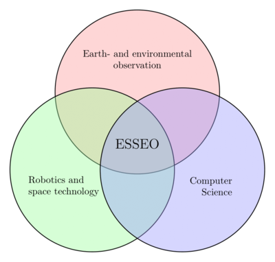
Space Technology
- Small small satellite development
- Hardware and Software
- Satellite communication networks
- Subsystem technology
Earth Observation
- Satellite image processing
- Image data fusion
- Artificial Intelligence (AI) and Machine Learning for Earth Observation
Robotics
- Robot navigation
- Human Robot Interaction and assistant robotics
- Human Brain Interface
Efficient Satellite Image Processing

From Raw Satellite Imagery to Harmonized Time Series: We create end-to-end processing pipelines that combine data from multiple Earth observation missions, maximizing the use of real observations before applying advanced gap-filling and fusion methods.
Image Fusion
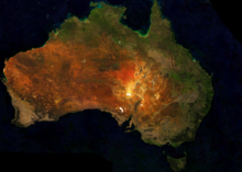
Smarter Satellite Data: We develop methods to process and fuse satellite images more efficiently—improving resolution, removing clouds, and enabling detailed monitoring for climate, agriculture, disasters, and urban planning.

NOVA
In the NOVA-project we are developing a novel payload for satellite onboard image processing using Machine Learning models running on FPGA-based AI-accelerator.
VAMEX
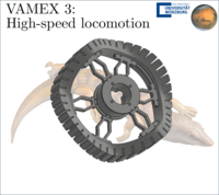
Within the VAMEX project, we contribute to advanced rover mobility concepts for the first German mission to Mars, focusing on high-speed locomotion and mechanically robust rover designs derived from bio-inspired principles.
UWE-5
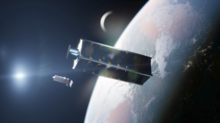
In the UWE-5 mission we aim to use two 3U-Cubesats to demonstrate integration of small satellite formations into a 5G communications network using Ka-band communication.
FORnanoSatellites
Modular and Standardized Nanosatellites: We develop unified hardware and software architectures that enable plug-and-play satellite components—streamlining design, boosting reliability, and scaling small-satellite production for diverse space missions.
Measurement Boxes for Environmental Observation
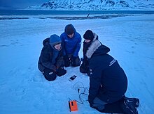
Using Embedded Systems to understand our environment: Using portable and stationary self-developed measurement boxes, we measure and log environmental information, particularly in arctic regions.
Super-Testsite - Cargo bike for environmental monitoring
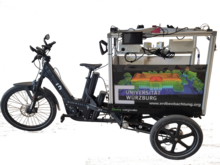
Interdisciplinary project for collecting environmental information: Sensors attached to bicycles collect data on air quality, vegetation, noise, and urban heat islands over a two-week period, which is then evaluated by scientists and students.
SENTRY
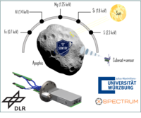
Remote sensing in the X-ray band: With SENTRY, the chair leads the development of technologies for X-ray–based navigation and remote sensing. The project focuses on advanced detector concepts and system-level studies for spaceborne X-ray applications.
Edge Inference for Robots and Satellites
Efficient AI for Robots & Satellites: We explore how machine learning models can run directly on-board, optimizing limited resources for faster decisions, reduced data load, and greater autonomy.
NetCDA - Capacity building, West Africa, Climate change

Climate change adaptation in Africa: With NetCDA, the chair strengthens academic education and research networks on climate change adaptation by connecting WASCAL graduate schools with European universities and research institutions.