Dr. Thomas van Dijk

Lehrstuhl für Informatik I
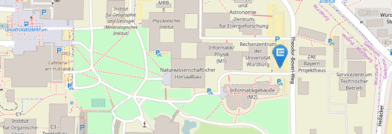
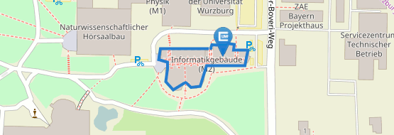
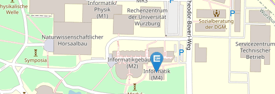
Universität Würzburg
Am Hubland
D-97074 Würzburg
Raum: 01.002, Gebäude M4
Tel.: +49 (0) 931-31-89040
Fax: +49 (0) 931-31-825200
Email: thomas.van.dijk@uni-wuerzburg.de
| Twitter: | @tvdmaps | GitHub: | tcvdijk |
| Youtube: |
Forschung
- Algorithmically-guided user interaction
- Algorithms for Geographic Information Systems
- Implementation; computational experiments
- Exact algorithms (exponential-time / parameterised ...)
Awards
- 2. Platz aus 15 ($300), ACM SIGSPATIAL Cup 2018. For “Wüpstream: efficient enumeration of upstream features (GIS cup),’’ with Tobias Greiner, Bas den Heijer, Nadja Henning, Felix Klesen, and Andre Löffler.
- Best Fast-forward Presentation at ACM SIGSPATIAL International Conference on Advances in Geographic Information Systems 2018. For “Realtime linear cartograms and metro maps,” with Dieter Lutz.
- Shortlist Junges Kolleg (Bayerische Akademie der Wissenschaften), Jahrgang 2017.
- ACM Computing Review’s “Best of Computing” list of notable publications, 2016. For ”Matching Labels and Markers in Historical Maps: An Algorithm with
Interactive Postprocessing,” with Benedikt Budig and Alexander Wolff. - Best Paper award, theory track, at the International Conference on Graph Drawing and Network Visualization. For “Block Crossings in Storyline Visualizations.” with Martin Fink, Norbert Fischer, Fabian Lipp, Peter Markfelder, Alex Ravsky, Subhash Suri, Alexander Wolff.
- Best Poster Award Runners up at ACM SIGSPATIAL International Conference on Advances in Geographic Information Systems 2015 (ACMGIS) for "There and Back Again: Using Fréchet-Distance Diagrams to Find Trajectory Turning Points." with Lukas Beckmann, Benedikt Budig and Johannes Schamel.
- Best Applied Paper Award at Discovery Science 2015 for "Active Learning for Classifying Template Matches in Historical Maps." [PDF] [
 Video] with Benedikt Budig.
 - Best student contribution at Schematic Mapping 2014 for "An automated method for circular-arc metro maps." [PDF] with Arthur van Goethem and Wouter Meulemans.
- Best paper at MapInteract 2014 for "Matching Labels and Markers in Historical Maps: an Algorithm with Interactive Postprocessing." with Benedikt Budig and Alexander Wolff.
- Best Fast-forward Presentation and Runner-up Best Poster at ACM SIGSPATIAL International Conference on Advances in Geographic Information Systems 2013 (ACMGIS) for "Accentuating Focus Maps via Partial Schematization." [PDF] with Arthur van Goethem, Jan-Henrik Haunert, Wouter Meulemans and Bettina Speckmann.
- Best Short Presentation at Web and Wireless GIS 2013 (W2GIS) for "A Probabilistic Model for Road Selection in Mobile Maps" [PPT] with Jan-Henrik Haunert.
Betreuung
Doktorarbeit
- Benedikt Budig. Extracting Spatial Information from Historical Maps: Algorithms and Interaction [Link beim Verlag] [digitale Version]
Masterarbeit
- Maximilian Schmitt: Tourenplanung unter Berücksichtigung heterogener Metriken.
- Andre Löffler: Snapping Graph Drawings to the Grid
- Benedikt Budig: Algorithmische Analyse historischer Landkarten
- Dieter Lutz: Realtime Linear Cartograms using Least-Squares Optimisation
Bachelorarbeit
- Fabian Sieper: Zuweisen von Kantenrichtungen in Metronetzen
- Julian Walter: Rotation and scale invariant template matching for historical maps
- Peter Markfelder: Optimale Zeichnungen von Storylines mit Blockkreuzungen
- Martin Becker: String Matching von historischen Toponymen
- Fabian Feitsch: From Many User-Contributed Polygons to One Polygon Consensus
- Lukas Beckmann: Analyse von Umkehrpunkten auf GPS-Trajektorien unter Verwendung der Fréchet-Distanz
Lehrveranstaltungen
| |
| SS20 | Vorlesung Algorithmen für geographische Informationssysteme |
| Seminar Algorithmen für Programmierwettbewerbe | |
| WS19 | Vorlesung Algorithmische Geometrie |
| SS19 | Vorlesung Algorithmen für geographische Informationssysteme |
| Seminar Algorithmen für Programmierwettbewerbe | |
| SS18 | Vorlesung Algorithmen für geographische Informationssysteme |
| Seminar Visualisierung von Graphen | |
| WS17 | Vorlesung Exakte Algorithmen (vollständige Überarbeitung des Inhalts) |
| SS17 | Vorlesung Algorithmen für geographische Informationssysteme |
| Seminar Algorithmen für Programmierwettbewerbe (inkl. Konzeption) | |
| WS16 | Seminar Algorithmen zur Extraktion von Daten aus alten Landkarten |
| SS16 | Vorlesung Algorithmen für geographische Informationssysteme |
| SS15 | Vorlesung Algorithmen für geographische Informationssysteme |
| WS14 | Seminar Visualisierung von geografischen Netzwerken |
| SS14 | Vorlesung Algorithmen für geographische Informationssysteme |
| WS13 | Übungen zu Approximationsalgorithmen |
| WS12 | Übungen zu Algorithmen für geografische Informationssysteme |
| SS12 | Übungen zu Exakte Algorithmen |
Veröffentlichungen
- [ 2020 ]
- [ 2019 ]
- [ 2018 ]
- [ 2017 ]
- [ 2016 ]
- [ 2015 ]
- [ 2014 ]
- [ 2013 ]
- [ 2011 ]
- [ 2010 ]
- [ 2009 ]
- [ 2008 ]
- [ 2007 ]
2020[ to top ]
-
Bundled Crossings Revisited. . In Journal of Graph Algorithms \& Applications, p. 35 pages. 2020.
2019[ to top ]
-
Algorithmically-Assisted Metro Map Design. In Proc. 2nd Schematic Mapping Workshop (SMW 2019), M. Roberts, M. Nöllenburg (eds.). 2019.
- [ BibTeX ]
-
Bundled Crossings Revisited. . In 35th European Workshop on Computational Geometry (EuroCG 19). 2019.
-
Practical Topologically Safe Rounding of Geographic Networks. . In Proceedings of the 27th {ACM} {SIGSPATIAL} International Conference on Advances in Geographic Information Systems, F. B. Kashani, G. Trajcevski, R. H. Güting, L. Kulik, S. D. Newsam (eds.), pp. 239–248. {ACM}, 2019.
2018[ to top ]
-
Stabbing Rectangles by Line Segments – How Decomposition Reduces the Shallow-Cell Complexity. . In Proc. 29th Ann. Int. Symp. Algorithms Comput. (ISAAC’18), Vol. 123 of LIPIcs, pp. 61:1–61:13. Schloss Dagstuhl -- Leibniz-Zentrum f{ü}r Informatik, 2018.
-
Realtime linear cartograms and metro maps. . In SIGSPATIAL/GIS, F. Banaei-Kashani, E. G. Hoel, R. H. Güting, R. Tamassia, L. Xiong (eds.), pp. 488–491. ACM, 2018.
-
Putting User Reputation on the Map: Unsupervised Quality Control for Crowdsourced Historical Data. . In 2nd ACM SIGSPATIAL Workshop on Geospatial Humanities. 2018.
-
Aktives Lernen f{ü}r Informationsextraktion aus historischen Karten. In Flächennutzungsmonitoring X, Vol. 76 of IOER, G. Meinel, U. Schumacher, M. Behnisch, T. Kr{ü}ger (eds.), pp. 181–186. RHOMBOS, 2018.
-
Wüpstream: efficient enumeration of upstream features (GIS cup). . In SIGSPATIAL/GIS, F. Banaei-Kashani, E. G. Hoel, R. H. Güting, R. Tamassia, L. Xiong (eds.), pp. 626–629. ACM, 2018.
2017[ to top ]
-
Algorithmically-Guided User Interaction. . In SIGSPATIAL’17 Proceedings of the 25th ACM SIGSPATIAL International Conference on Advances in Geographic Information Systems, E. Hoel, S. D. Newsam, S. Ravada, R. Tamassia, G. Trajcevski (eds.), pp. 11:1–11:4. ACM, 2017.
-
Journeys of the Past: A Hidden Markov Approach to Georeferencing Historical Itineraries. In GIR’17 Proceedings of the 11th Workshop on Geographic Information Retrieval, C. B. Jones, R. S. Purves (eds.), pp. 7:1–7:10. ACM, 2017.
-
Computing Storyline Visualizations with Few Block Crossings. . In Proceedings of the 25th International Symposium on Graph Drawing and Network Visualization, F. Frati; K.-L. Ma (eds.). 2017.
-
Block Crossings in Storyline Visualizations. . In Journal of Graph Algorithms \& Applications, 21(5), Y. Hu; M. Nöllenburg (eds.), pp. 873–913. 2017.
2016[ to top ]
-
Matching Labels and Markers in Historical Maps: an Algorithm with Interactive Postprocessing. . In Transactions on Spatial Algorithms and Systems. 2016.
-
Block Crossings in Storyline Visualizations. . In Proc. 24nd Int. Sympos. Graph Drawing. 2016.
-
Location-dependent generalization of road networks based on equivalent destinations. . In Comput. Graph. Forum, 35(3), pp. 451–460. 2016.
-
Snapping Graph Drawings to the Grid Optimally. . In Proc. 24nd Int. Sympos. Graph Drawing. 2016.
-
Glyph Miner: A System for Efficiently Extracting Glyphs from Early Prints in the Context of OCR. . In Proceedings of the 16th ACM/IEEE-CS on Joint Conference on Digital Libraries, of JCDL ’16, N. R. Adam, L. (Boots) Cassel, Y. Yesha, R. Furuta, M. C. Weigle (eds.), pp. 31–34. ACM, 2016.
2015[ to top ]
-
There and Back Again: Using Fréchet-Distance Diagrams to Find Trajectory Turning Points. . In Proceedings of the 23rd ACM SIGSPATIAL International Conference on Advances in Geographic Information Systems (ACM SIGSPATIAL 2015), pp. 238–241. ACM, 2015.
-
Active Learning for Classifying Template Matches in Historical Maps. . In Discovery Science, Vol. 9356 of Lecture Notes in Computer Science, N. Japkowicz, S. Matwin (eds.), pp. 33–47. Springer International Publishing, 2015.
2014[ to top ]
-
Matching Labels and Markers in Historical Maps: an Algorithm with Interactive Postprocessing. In Proceedings of the 2nd ACM SIGSPATIAL International Workshop on MapInteraction. 2014.
-
Improved Approximation Algorithms for Box Contact Representations. . In Proc. 22th Annual European Symposium on Algorithms (ESA’14), pp. 87–99. 2014.
-
Interactive focus maps using least-squares optimization. . In International Journal of Geographical Information Science, 28(10), pp. 2052–2075. 2014.
-
Map Schematization with Circular Arcs. . In Geographic Information Science, 8728, M. Duckham; E. Pebesma; K. Stewart; A. Frank (eds.), pp. 1–17. Springer International Publishing, 2014.
-
An Automated Method for Circular-Arc Metro Maps. In Schematic Mapping. 2014.
- [ BibTeX ]
-
How to Eat a Graph: Computing Selection Sequences for the Continuous Generalization of Road Networks. In Proceedings of the 22st ACM SIGSPATIAL International Conference on Advances in Geographic Information Systems, Vol. 28, pp. 243–252. 2014.
-
Inclusion/Exclusion Meets Measure and Conquer. In Algorithmica, 69(3), pp. 685–740. Springer US, 2014.
2013[ to top ]
-
Accentuating Focus Maps via Partial Schematization. . In Proceedings of the 21st ACM SIGSPATIAL International Conference on Advances in Geographic Information Systems, of SIGSPATIAL’13, pp. 428–431. ACM, Orlando, Florida, 2013.
-
Road Segment Selection with Strokes and Stability. In Proceedings of the 1st ACM SIGSPATIAL International Workshop on MapInteraction, of MapInteract ’13, pp. 72–77. ACM, Orlando, Florida, 2013.
-
A Probabilistic Model for Road Selection in Mobile Maps. . In Web and Wireless Geographical Information Systems, Vol. 7820, S. H. Liang, X. Wang, C. Claramunt (eds.), pp. 214–222. Springer Berlin Heidelberg, 2013.
2011[ to top ]
-
Optimizing Wireless Sensor Network Flow by Column Generation. In Conference of the European Chapter on Combinatorial Optimization. 2011.
- [ BibTeX ]
2010[ to top ]
-
A Cubic Kernel for Feedback Vertex Set and Loop Cutset. In Theory of Computing Systems, 46(3), pp. 566–597. Springer-Verlag, 2010.
2009[ to top ]
-
Inclusion/Exclusion Meets Measure and Conquer. In Algorithms - ESA 2009, Vol. 5757, A. Fiat, P. Sanders (eds.), pp. 554–565. Springer Berlin Heidelberg, 2009.
2008[ to top ]
-
Integer Maximum Flow in Wireless Sensor Networks with Energy Constraint. . In Algorithm Theory - SWAT 2008, Vol. 5124, J. Gudmundsson (ed.), pp. 102–113. Springer Berlin / Heidelberg, 2008.
2007[ to top ]
-
Kernelization for Loop Cutset. M. D. Edwin de Jong (ed.). 2007.