Geographic Information Systems


Algorithms for Geographic Information Systems
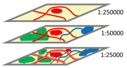
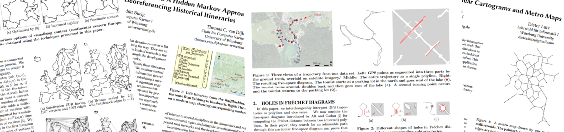
A Geographic Information System (GIS) allows users to acquire, administrate, analyze, and visualize geographic information. In this context, algorithmic problems arise, which often are of geometric nature. For instance, building footprints have to be generated automatically from raw data (e.g., from 3-dimensional point clouds acquired by laser scanning). Generally, the level of detail and the level of abstraction of a geospatial dataset have to fit a given application – urban planning, for example, needs more detailed data than climate modelling. Therefore, algorithms for map generalization are needed, which adapt a geospatial dataset to a lower level or detail (or higher level of abstraction). In particular, generalization is used in cartographic visualization to generate small-scale maps from large-scale maps.
Contact: Alexander Wolff